


By Sean Delaney
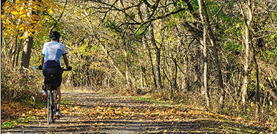
The Humber River Recreation Trail is a peaceful retreat for those eager to explore the scenic stretches along the Humber River from Islington Avenue down to Lake Ontario. As one of Toronto’s longest trails, it passes through parks, woodlands, and riverbanks, offering serene escapes and a chance to discover diverse local wildlife and plants.
For both cyclists and pedestrians, this trail offers a continuous, well-maintained paved path that’s ideal for biking, walking, and jogging. The City of Toronto provides a Cycling Network Map, a valuable tool that includes detailed information on cycle tracks, bike lanes, and multi-use trails across the city. This map helps you plan your journey, ensuring you can find access points and facilities easily.
Additionally, the city’s website lists Discovery Walks, which are curated routes that offer a blend of natural beauty and historical insights. The Humber River, Old Mill & Marshes walk begins at the Old Mill Subway Station and features landmarks like the Old Mill and riverside parklands. Although designed for walking, these routes also give cyclists a preview of what they can enjoy on nearby paths.
For more detailed information on the Humber River Recreation Trail and other recreational activities in the area, visit the City of Toronto’s official website, especially the Parks and Recreation section and the Cycling Network Map page. These resources are invaluable for anyone looking to explore Toronto’s outdoors, whether for leisure, exercise, or commuting.
The cycling map displays all of Toronto’s cycling infrastructure, categorized by type. You can customize your route by inputting your starting location and selecting the type of bikeway you prefer from the ‘Filter Results’ option. The map provides information on on-street and off-street bikeways, bike share stations, and suggests routes for various destinations, including work, school, and leisure spots around the City.
Please note that paper maps are not mailed to individual addresses. However, the 2023 Toronto Cycling Maps are available at Toronto Public Library branches, community and recreation centres, and bike shops throughout Toronto. Additionally, you can scan the provided QR code for detailed information on trails, bike paths, mixed-use paths, and walking trails.
This guide ensures you have all the information needed to enjoy and explore the Humber River trails effectively, enriching your experience in one of Toronto’s most picturesque settings.